Costa Blanca Cycle Map
The coastal zone and mountains around Dénia, Jávea, Moraira, Calpe, Altea & Benidorm
ActiveMaps researched, designed and produced this cycling map.
On sale online here:
Also at bookshops:
- ISBN-10: 0955919118
- ISBN-13: 978-0955919114
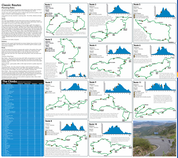
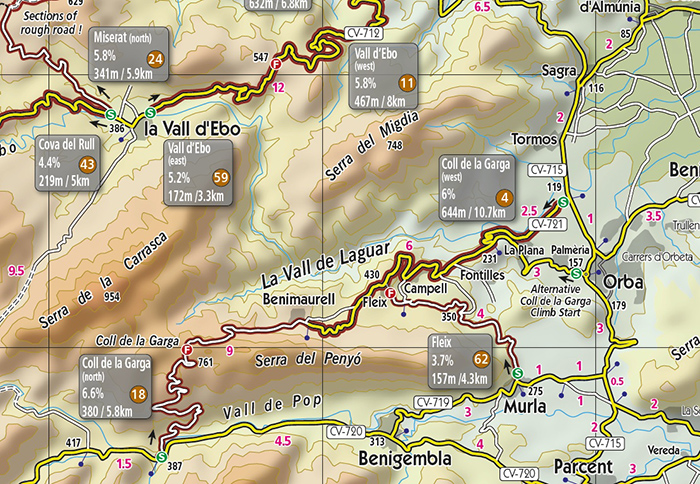
North Costa Blanca Cycle Map is a dedicated road cycle map covering an area that offers some of the best cycling in Europe. Includes the challenging climbs of Coll de Rates, Port de Tudons, Port de Confrides, Miserat, Vall d'Ebo and many more.
Easy to use for planning and printed on waterproof and tough paper the map is ideal for taking out on a ride.
Main map features
Climbs above 3% gradient and over 100 meters of ascent are marked on the map, with a start and finish point. Key data of length, average gradient, and amount of ascent are shown next to each climb. The climbs have a ranking number based on the amount of ascent to aid comparisons.
Roads are classified by size and a symbol is used for roads that are in disrepair. Distance markers are shown between key junctions, contours are every 100m with layered colouring, spot heights are shown along the road.
Main towns include Dénia, Javea, Moraira, Calpe, Jalon, Villalonga, Pego, Benidorm, Castell de Castelles, Lorcha.
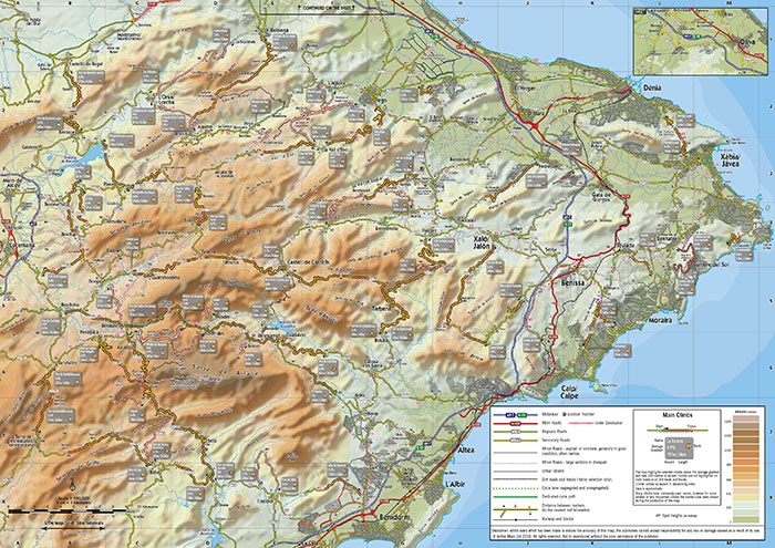
Clear road classifications, text and symbols
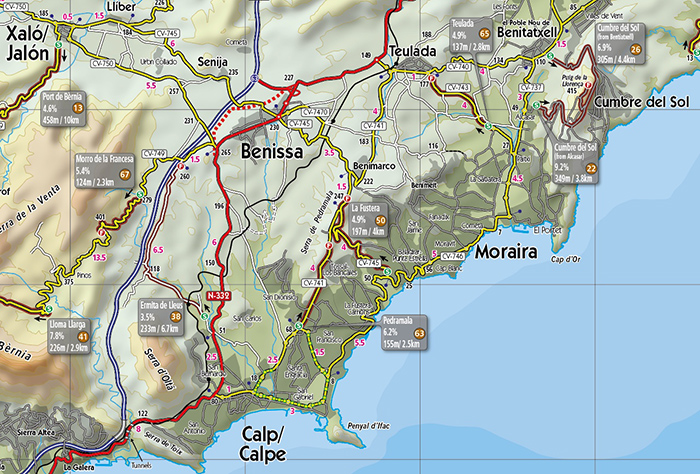
The climbs have the start and finish marked by icons. There is an accompanying text box with key climb data; climb name, average gradient, distance and height climbed. In addition the climbs are ranked. Grid squares are 5km. Distances are marked between junctions. Heights are shown in metres at key points along the roads.
Printing is on extremely tough and waterproof paper.
The map also includes route suggestions